| Nunhead roads |  |
Abbey Wood
Anerley & Penge
Beckenham
Bermondsey
Bexley
Blackheath
Borough
Brixton
Brockley
Bromley
Camberwell
Catford
Charlton
Croydon
Crystal Palace
Deptford
Dulwich Village
East Dulwich
Elephant and Castle
Eltham
Forest Hill
Greenwich
Herne Hill
Kennington
Lee
Lewisham
New Cross
Old Kent Road
Peckham
Rotherhithe
Southbank
Sydenham
Walworth
West Norwood
Woolwich
Info |
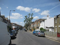
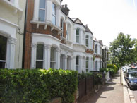
Athenlay Road |
Bellwood Road |
Cheltenham Road |
 |
 |
 |
 |
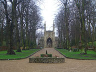
Nunhead borders are Queens Road, Consort Road, Laussane Road and Peckham Rye (north). Nunhead Railway station opened in 1872. Here is a map of the area pre-development. The area around the station was developed in the 1870s onwards by several developers including * Dodds and south Nunhead was created by Edward Yates who built the Waverley Park Estate from the 1880s on fields by Nunhead Cemetery. |
map Part of the Waverley Park Estate. Named in 1886 |
map |
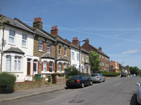
map Previously Hill Road and part of the Newlands estate. Renamed in 1938. Served by the 343 and 484 buses. |
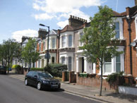
Harlescott Road |
Ivydale Road |
Lanbury Road |
Limesford Road |
 |
 |
 |
 |
| map Part of the Waverley Park Estate . Named in 1886 after a Shropshire place name (the developer Edward Yates was from Shrewsbury). |
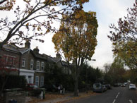
map Lengthy road linking Nunhead with Brockley. Part of the Waverley Park Estate. Named in 1886 and developed from 1884-1900. Dale refers to its position betweek Nunhead Hills and Telegraph Hill. Served by P12 bus. |
map |
map |
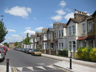
Linden Grove |
St Mary’s Road |
Stuart Road |
Surrey Road |
 |
 |
 |
|
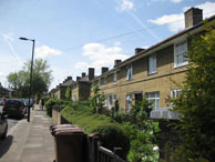
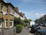
| Map Developed from 1872. A grove of lime trees. Linden Road borders Nunhead Cemetery. |
Map Runs between St Mary’s Road was named in 1878 after the original St Mary Church which was consecrated in 1841 and destroyed in WW2. |
Map |
Map Part of the Newlands estate and named in 1897. Nunhead originally was in Surrey. |