| Brixton Property Guide: Central Brixton roads |
Abbey Wood
Anerley & Penge
Beckenham
Bermondsey
Bexley
Blackheath
Borough
Brixton
Brockley
Bromley
Camberwell
Catford
Charlton
Croydon
Crystal Palace
Deptford
Dulwich Village
East Dulwich
Elephant and Castle
Eltham
Forest Hill
Greenwich
Herne Hill
Kennington
Lee
Lewisham
New Cross
Old Kent Road
Peckham
Rotherhithe
Southbank
Sydenham
Walworth
West Norwood
Woolwich
Local info |
Arlingford Road |
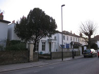
Brixton Water Lane |
|
 |
 |
 |
|
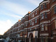
Central Brixton is shown here as being between Ferndale Road, Sudbourne Road, Brixton Water Lane and Atlantic Road. |
map |
map C19 Formerly Watery Lane. A tributary of the Effra ran along the east side |
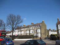
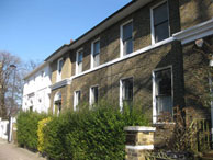
map Built in 1810 on land that was part of Effra Farm. 45-47 are listed |
Porden Road |
Rushcroft Road |
St Matthews Road |
Trinity Gardens |
 |
 |
 |
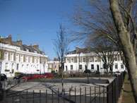 |
| map | map | map 1-5 are 1825-7 with Greek Doric doorways. |
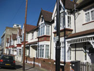
map Peaceful road with a good pub. c. 1820s. Leads to Trinity almshouses, originally Trinity Asylum. It was founded in 1822 by Thomas Bailey for “pious aged women”. |