Brockley Property Guide
Abbey Wood
Anerley & Penge
Beckenham
Bermondsey
Bexley
Blackheath
Borough
Brixton
Brockley
Bromley
Camberwell
Catford
Charlton
Croydon
Crystal Palace
Deptford
Dulwich Village
East Dulwich
Elephant and Castle
Eltham
Forest Hill
Greenwich
Herne Hill
Kennington
Lee
Lewisham
New Cross
Old Kent Road
Peckham
Rotherhithe
Southbank
Sydenham
Walworth
West Norwood
Woolwich
This is a unique guide to the best period roads for houses and flats in Brockley, SE4 in the London Borough of Lewisham. Brockley is bordered by Nunhead, Honor Oak, New Cross and Lewisham. It was originally a small settlement in Kent near to London. The arrival of the Croydon Canal and the railway led to its rapid growth in the 19th Century. Past residents include the artist and poet David Jones and the novelist Edgar Wallace. Brockley is served by two railway stations Brockley (London Overground) and Crofton Park (Thames Link).
Brockley’s best residential roads for houses and flats to buy or let are detailed in three period groupings:
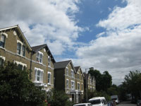 |
Victorian Brockley Property Guide |
|
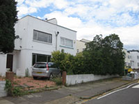 |
C20 Brockley Property Guide
|
|
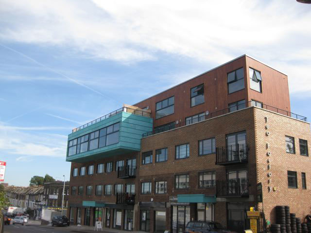 |
C21 Brockley Property Guide
|