Sydenham Property Guide: Central Sydenham roads
Anerley & Penge
Beckenham
Bermondsey
Bexley
Blackheath
Borough
Brixton
Brockley
Bromley
Camberwell
Catford
Charlton
Croydon
Crystal Palace
Deptford
Dulwich Village
East Dulwich
Elephant and Castle
Eltham
Forest Hill
Greenwich
Herne Hill
Kennington
Lee
Lewisham
New Cross
Old Kent Road
Peckham
Rotherhithe
Southbank
Sydenham
Walworth
West Norwood
Woolwich
Info |
Bishopsthorpe Road |
Byne Road |
Dukesthorpe Road |
 |
 |
 |
 |
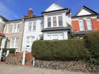
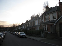
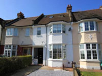
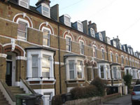
Borders: Silverdale and Mayow Road. History: A history of the ”Thorpes” |
map One of the six roads of the Thorpe Estate were developed between 1901 and 1914 by Edmonson and Sons. In 2001 it was designated a conservation area |
map |
map One of the six roads of the Thorpe Estate were developed between 1901 and 1914 by Edmonson and Sons. In 2001 it was designated a conservation area |
Earlsthorpe Road |
Girton Road |
Kingsthorpe Road |
Queensthorpe Road |
 |
 |
 |
 |
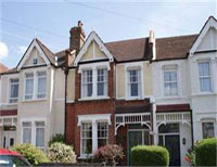
| map One of the six roads of the Thorpe Estate were developed between 1901 and 1914 by Edmonson and Sons. In 2001 it was designated a conservation area |
map |
map |
map |
Princethorpe Road |
Tannsfeld Road |
Venner Road |
Wiverton Road |
 |
 |
 |
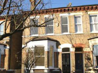 |
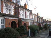
| Map One of the six roads of the Thorpe Estate were developed between 1901 and 1914 by Edmonson and Sons. In 2001 it was designated a conservation area. |
Map |
Map |
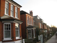
Map Built in the 1880s on the site of Newland after the last owner, William Smith, died in 1877 and the Newlands estate was sold for development. |